
We’re all familiar with the 2D version of Google Maps.

BUT… did you know you can now hold CTRL + drag with the mouse to enter an incredible 3D version of our beautiful part of London?
Now, some of you will be thinking ‘that feature has existed for years’, and you’re right. However, Google only recently extended the 3D rendering to include everything west of Battersea Park, and we’re very excited about it!
So, here’s our top 21 aerial views of campus and beyond now available on Google Maps.
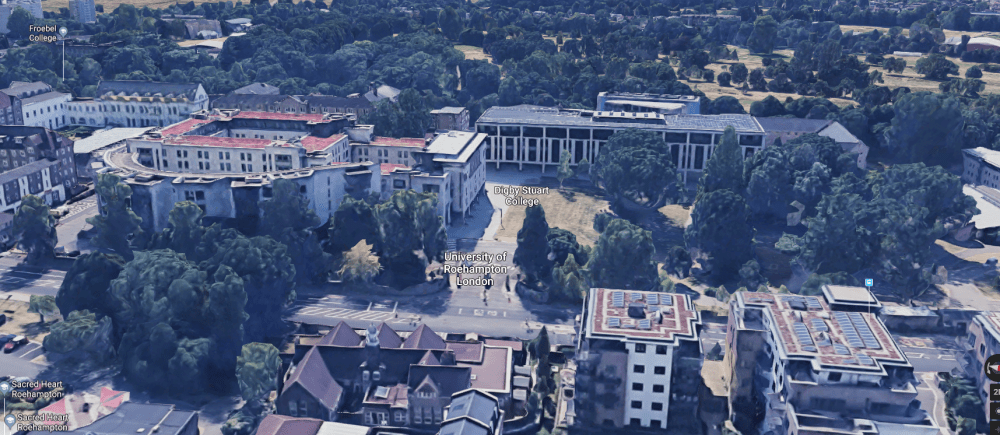
1. Froebel College looking towards Digby College.

2. Froebel Lawn, Froebel Lake and the grounds of Grove House.

3. Digby Stuart College: Lee House, Bede House, Newman House, Elm Grove Hall, Jubilee and Harvey.

4. Digby Stuart College: A west-facing view of campus including our beautiful new library.
5. Southlands College.

6. Parkstead House on Whitelands College.

7. The incredible view of Richmond Park seen from our Whitelands campus.

8. Mount Clare House, one of several listed structures and buildings which are part of the University of Roehampton.

9. Richmond Park, the largest of the Royal Parks in London. The blue marker shows where campus is located in relation to the park.

10. Our Roehampton Lane neighbours Queen Mary’s Hospital.

11. And our local train station tucked away between the trees, Barnes Station.

12. A little further up the road is the London Wetland Centre.

13. Just across the River Thames is Craven Cottage. Home of, currently, Premier League club Fulham FC.

14. The hub of SW15, Putney.

15. Hammersmith Broadway and the Hammersmith Apollo, a short ride on the 72 bus from campus.

16. Hammersmith Bridge; crossed by the said 72 bus route from campus.

17. The Queens Club, just outside of Hammersmith.

18. Further east from Hammersmith you will find Stamford Bridge, home of Chelsea FC, and Brompton Cemetery (another of London’s Royal Parks).

19. Sticking with the sports theme, the All England Lawn Tennis & Croquet Club, venue for the Wimbledon Tennis Championships, is the opposite side of Putney Heath from Roehampton.

20. And if you take a westbound train from Barnes a few stops you’ll get to the home of English rugby: Twickenham Stadium.

21. And finally, every Roehampton student will know and appreciate this aerial view. Please hold the hand rail while travelling.

Head over to Google Maps and take a look for yourself.
Of course, you still can’t beat a stroll around our leafy parkland campus on a sunny day, but if you’re unable to do that, this is a fantastic alternative. Enjoy!